The genesis of AIS dates back to the late 20th century when the International Maritime Organization (IMO), in response to the growing need for maritime safety, sought to create a global standard for ship-to-ship and ship-to-shore communication. What emerged was a sophisticated system that not only promotes safety but also underpins the smooth operation of marine traffic management systems around the world.
The foundation of Automatic Identification Systems (AIS) relies on several critical elements that work in unison to provide the technical prowess that streamlines marine navigation and communication. The ensemble comprises four main components: a VHF radio transceiver, a GPS receiver, a processing unit, and a means of display. Each of these plays a specialized role in the functional symphony that is AIS, collectively enabling the automated exchange of critical navigational data among vessels and between ships and shore-based facilities.
At the center of the AIS system is the VHF radio transceiver. This piece of equipment acts akin to a diligent postal service for digital information, continually broadcasting and receiving signals containing significant data packets. These packets are structured in AIS-standardized messages that ensure interoperability among diverse maritime entities, regardless of their country of origin or manufacture. Given the VHF technology’s line-of-sight transmission characteristics, the radio transceiver effectively covers a range typically up to 20 nautical miles, making it ideal for real-time, regional marine communication.
 Complementing the transceiver is the GPS (Global Positioning System) receiver. The GPS receiver furnishes highly accurate geographic location details integral to navigational data sets. By continually updating a vessel’s position, heading, and speed, it delivers the dynamic variables needed to paint an accurate picture of a moving maritime landscape. These continuous updates are particularly crucial in the high-traffic sea lanes where knowing one’s precise location at every moment can mean the difference between a close call and a calamity.
The processing unit serves as the AIS system’s brain, diligently collating and parsing data from the GPS receiver, other on-board instruments, and manual inputs. This data is then formatted into the distinct AIS message types, ready for transmission via the VHF transceiver. Conversely, when receiving data from other ships and stations, the processing unit interprets the incoming messages, extracting information to be conveyed to the crew. Considering the critical nature of this information, the processing must be carried out swiftly and accurately to ensure that all decisions are based on the most current data available.
The display system acts as the interface between human operators and the esoteric world of transmitted data. Typically integrated into the ship’s existing navigational apparatus, such as the Electronic Chart Display and Information System (ECDIS), the display offers a user-friendly visual context. It may depict surrounding vessels as icons on a map, each tagged with AIS-derived information, such as identity, course, and speed. Some systems enable additional overlays, like historical vessel tracks and predicted paths, augmenting the decision-making toolkit available to the navigator.
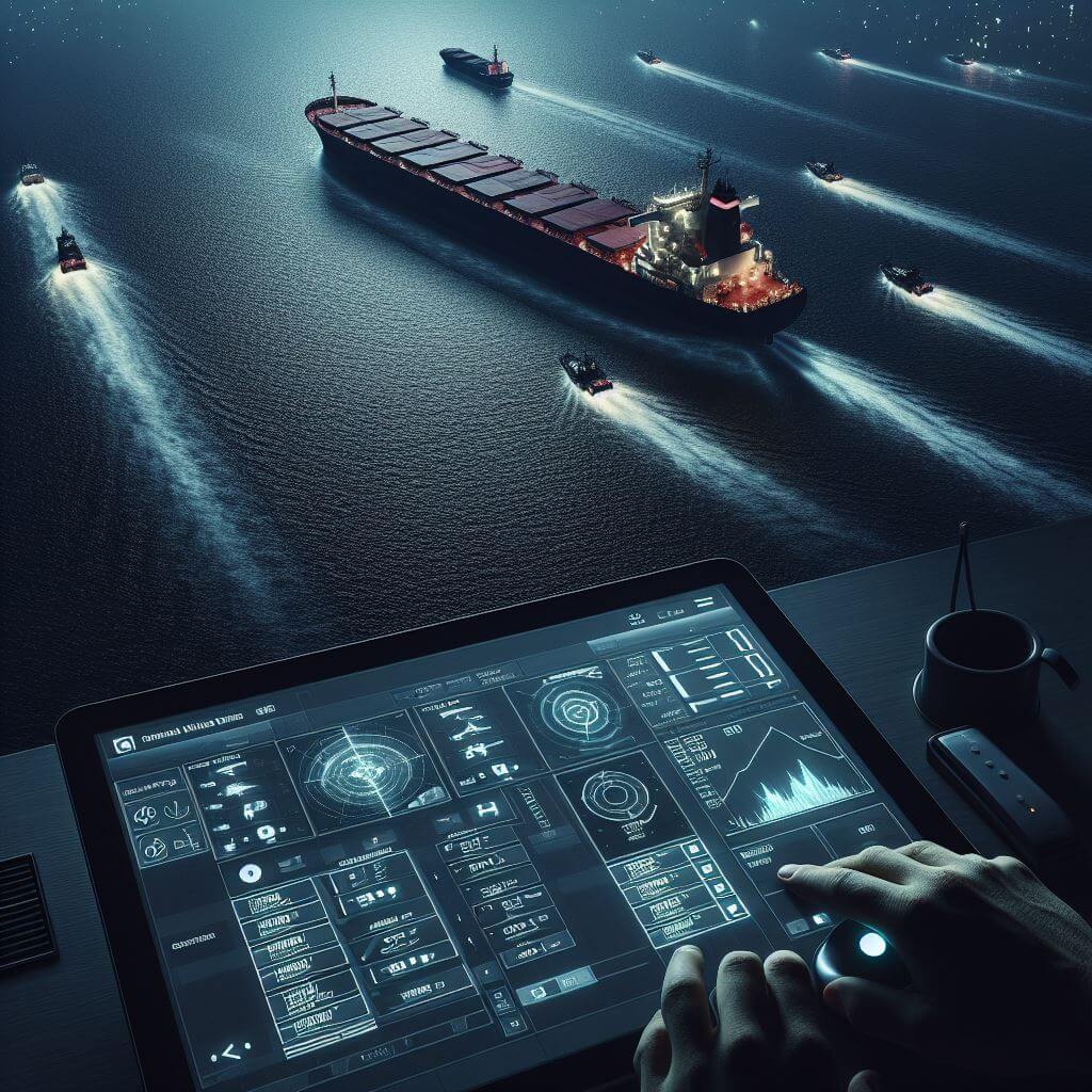
AIS in Maritime Safety and Traffic Management
By enabling the real-time exchange of vessel information, AIS has radically transformed how maritime safety is approached, serving as a vital enhancement to traditional tools used in navigation and collision avoidance. This advanced system has proven to be particularly beneficial in congested sea lanes, around busy ports, and during challenging weather conditions, where it heightens situational awareness and reduces the risk of maritime incidents.
The efficacy of AIS in avoiding on-water collisions is one of its most compelling attributes. By sharing crucial navigational information such as location, heading, speed, and vessel status with other ships and shore-based authorities, AIS creates a dynamic marine landscape where captains have access to a wealth of data that was previously inaccessible. This network of shared data allows vessels to be cognizant of each other’s intentions and movements, empowering them to predict potential points of conflict well before they become critical. In situations of low visibility, such as fog or heavy rain, AIS fills in the gaps left by visual lookout and radar, providing a consistent and reliable stream of information.
AIS assists in complementing radar, the traditional mainstay of marine navigation. While radar systems are adept at detecting other ships and mapping their positions relative to the landscape, they sometimes struggle with identifying specific vessels among a crowded sea-space or in treacherous weather conditions. AIS seamlessly supplements this by providing definable and detailed vessel information, strengthening navigators’ ability to make informed decisions.
The system’s contribution extends into maritime traffic management systems, paralleling its value for individual vessels. Vessel Traffic Services (VTS) utilize AIS as a real-time tracking solution to monitor the movements of ships, ensuring that large and potentially hazardous cargos are managed appropriately through narrow channels and straits. AIS serves as a proactive traffic management tool, helping to maintain orderly and controlled transit through busy maritime thoroughfares and reducing the likelihood of logjams or accidents.
In the context of emergency response and search and rescue operations, AIS is vital. When distress signals are activated, AIS aids rescuers by immediately providing the vessel’s identity and location, drastically narrowing the search area and cutting down response times. Maritime authorities can also track a ship’s past positions through AIS data, which can be critical in piecing together the events that led to an accident or in planning effective emergency responses.
The implementation of AIS has operational benefits for coastal states and maritime regulatory bodies. AIS data capture allows for the analysis of shipping patterns, monitoring of fishing activities, and detection of potential maritime security threats. The system also facilitates the application and enforcement of maritime regulations, such as those concerning environmental protection and restricted areas, by enabling authorities to oversee maritime activities within their jurisdiction with greater precision.
The Impact of AIS on the Future of Maritime Operations
One of the most anticipated developments in maritime logistics is the rise of autonomous, or unmanned, vessels. These futuristic ships promise to revolutionize shipping by making it more efficient, reducing the potential for human error, and optimizing crew safety. AIS will be foundational in this new era, equipping these smart vessels with the means to communicate their position, route, and other essential navigational data to other ships, as well as to remote monitoring stations or automated port installations.
Beyond autonomous shipping, AIS data integration promises considerable advancements in maritime traffic analytics and fleet management. The wealth of information generated by AIS—covering everything from vessel movements and speeds to port activity—can be aggregated and analyzed to improve marine traffic efficiency, forecast potential bottlenecks, and enhance overall supply chain logistics. Data scientists and shipping analysts can leverage AI and machine learning algorithms to parse through this trove of AIS data to identify patterns, optimize routes, and reduce fuel consumption, thereby contributing to greener shipping practices.
The marine industry’s commitment to protecting the environment is another area where AIS displays its future potential. As environmental regulations continue to tighten, AIS provides a tool for monitoring compliance with emission control areas (ECAs) and tracking vessels that may be involved in illegal practices such as bilge dumping. It ensures that vessels are accountable for their environmental footprint, making it easier for authorities to enforce regulations and for ship operators to document their compliance.
The role of AIS in maritime security is set to expand further. By continuously monitoring vessel movements, AIS acts as a deterrent to illicit activities, such as piracy or smuggling, which depend on stealth and surprise. The system can be integrated into national and international maritime domain awareness (MDA) initiatives, contributing to a shared operational picture that enhances security and helps authorities respond promptly to any security threat.
There is the promise of enhanced search and rescue capabilities with AIS. As search and rescue (SAR) operations benefit from better-coordinated efforts and improved location accuracy, AIS can be expected to provide critical, real-time data that can be instantly shared with relevant authorities and SAR teams around the globe, leading to more successful outcomes in emergencies at sea.